Introduction
Overview
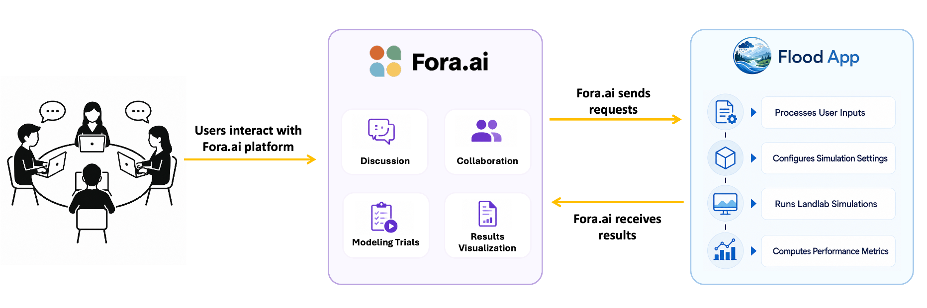
Flood App is a RESTful web service that integrates with the Fora.ai platform to support participatory watershed modeling. Built on Landlab, the service performs watershed-scale simulations of surface runoff and soil infiltration based on user-defined landscape conditions and mitigation interventions.
Community users interact through the Fora.ai platform to discuss, collaborate, and design modeling scenarios that incorporate mitigation measures such as berms and mulch. Fora.ai sends GeoJSON-based map data to Flood App through a REST API, where the inputs are processed and translated into physics-based simulations using Landlab components. Simulations are executed asynchronously, and the resulting outputs are returned to Fora.ai for visualization, scenario comparison, and decision support.
The system is designed to facilitate participatory modeling, enabling stakeholders to evaluate alternative mitigation strategies, assess flood impacts, and support watershed management decisions.
Intervention Types
Three intervention types can be applied to landscape cells via the GeoJSON input.
Type |
Description |
|---|---|
|
Raises cell elevation by 1 m and adjusts hydraulic conductivity and Manning’s roughness. |
|
Raises cell elevation by 2 m and adjusts hydraulic conductivity and Manning’s roughness. |
|
Modifies hydraulic conductivity and Manning’s roughness; no change to terrain elevation. |
Input Example
An example request JSON file can be found in
test_request_geojson_valid.json.
Output Files
File |
Contents |
|---|---|
|
Per-timestep water depth grid |
|
Per-timestep infiltration depth grid |
|
Maximum water depth (ESRI ASCII) |
|
Maximum water depth grid (JSON) |
|
Elevation grid of delineated watershed |
|
Time series of outlet discharge |
|
Cumulative discharge percentage |
|
Cumulative infiltration percentage |
|
Damage cost, flooded area, investment NPV |